Splice.me and 3-GIS both help organizations manage fiber networks, but they focus on different workflows. 3-GIS is a comprehensive GIS platform used by large telecom operators, while Splice.me specializes in creating fiber design and managing splice schematics with no training.
What is Splice.me?
Splice.me is a web-based fiber network management software used to quickly create, alter, and manage fiber optic splice diagrams and documentation. It replaces traditional spreadsheets and complex CAD programs with a streamlined platform for designing and tracking fiber paths. No matter how small or big is your fiber network, Splice.me can help you lay out the design in minutes. Supports export to PDF, to excel sheets, and to CAD programs via SVG output.
Pros: Lightweight, Fast, AffordableCons: Focused mainly on splice-level management
What is 3-GIS?
3-GIS is a web-based geographic information system software and services company that helps telecommunications, electric, and gas utilities plan, design, build, and manage physical network assets. The name stands for the “third generation” of GIS, which evolved from paper and desktop CAD systems into a modern web and mobile platform.
Pros: Super-powerful enterprise-scale GIS; Mobile & field supportCons: Long onboarding, Complex, Expensive
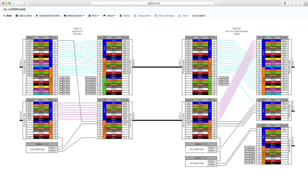
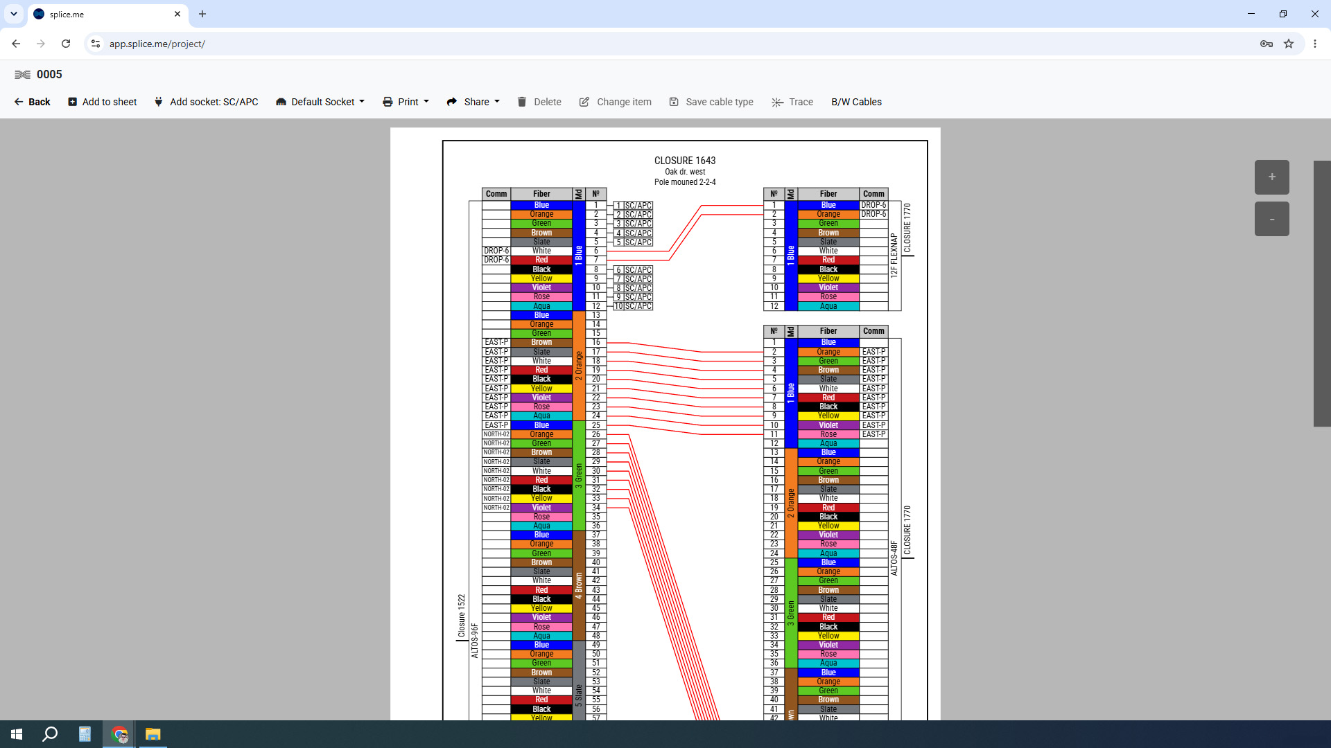
Splice.me interface
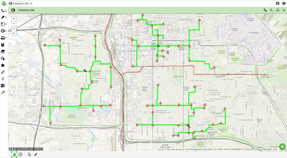
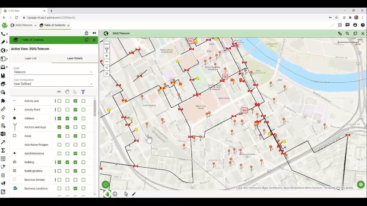
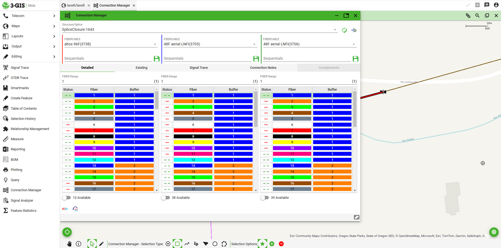
3-GIS interface
How fiber splice diagrams are handled?
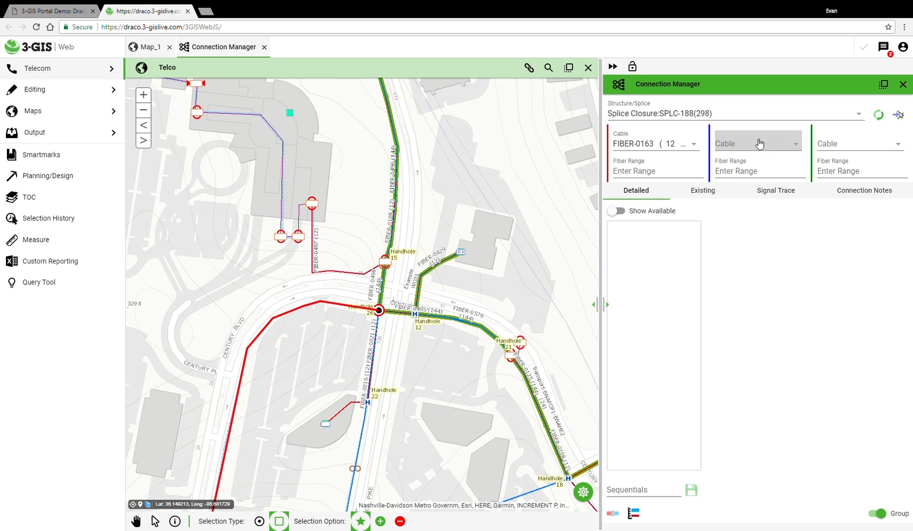
Fiber diagrams in 3-GIS
Splice.me approach to the same diagram,
made in several clicks
Splice.me and 3-GIS features
| Feature | Splice.me | 3-GIS |
| Cloud SaaS | ✔️ | ✔️ |
| GIS | noGIS | GIS-heavy |
| Outside plant records | ✔️ | ✔️ |
| Fiber splicing | ✔️ Ultra fast | ❌ Bloody hard |
| Team collaboration | ✔️ | ✔️ |
| Enterprise integrations | ✔️ | ✔️ |
| API | ❌ Planned | ✔️ |
| Mobile field app | ❌ N/A | ✔️ |
| PDF XLS SVG export | ✔️ | ✔️ |
| Price | Low | High |
| Complexity | Low | High |
Choose Splice.me if
- You’re looking for an affordable solution for an ISP, contractor, or engineering team
- Your team currently relies on Excel, Visio, or PDFs for splice documentation
- You need to create and maintain fiber splice data quickly
- You want an intuitive, lightweight browser-based tool
Choose 3-GIS if:
- You manage telecom or utility infrastructure, requiring web-based fiber network documentation, real-time field-to-office updates, and Esri-integrated spatial data management
- You want your software to operate seamlessly on top of Esri technology for robust enterprise scaling
Honestly:
Both platforms serve the fiber industry, but they address different needs. 3-GIS offers significantly broader GIS capabilities than Splice.me, including advanced spatial asset management. Organizations that require a complete GIS platform + fielding + project & workforce management may prefer 3-GIS despite the higher implementation complexity and complexity in general.
Splice.me has become an essential part of our workflow. Every fiber network change goes into Splice.me first, helping us avoid mistakes and saving a lot of time on rework.
Mark Loilitias
CEO @ Mountain Tech Cabling
FAQ
Which software is easier to learn?
Splice.me is designed for quick adoption by fiber engineers and technicians. The app is so user-friendly that it requires literally no training at all.
Does Splice.me support fiber tracing?
Yes. Splice.me includes interactive fiber tracing, allowing users to visually follow fibers through splice points and simplify troubleshooting and network documentation.
Can I try Splice.me before purchasing?
Yes. Splice.me offers a free trial, allowing you to explore its features and determine whether it fits your workflow before committing to a paid plan.
Which solution is better for small and mid-sized ISPs?
Splice.me is well suited for small and medium-sized ISPs, contractors, and engineering firms that need an easy-to-use splice management solution. Larger telecom operators with enterprise GIS requirements may find GIS-heavy platforms a better fit.
Why choose Splice.me over other software?
Choose Splice.me if your primary goal is fast, accurate fiber splice documentation without the complexity of a full enterprise GIS. Organizations that need comprehensive asset management, advanced mapping, and enterprise integrations may find other software a better match.
Why does Splice.me have no GIS?
Because when you decide to map your fiber network in some software, you assume it is a solution for your pain point. But all that GIS mapping and drawing is a whole new pain by itself, and it creates new pain points – the need to keep it up to date, the complexity of some features, and the abscence of desired features.